A walk to Stonehenge through one of the richest archaeological landscapes in the UK.
Part III – The final journey. From Durrington Walls to Stonehenge.
This is part three of a personal pilgrimage from my house in Calne, Wiltshire to Stonehenge for the Stonehenge winter solstice. I am walking the 28 mile route across central Wiltshire with my friend Clive, a born-and-bred Wiltshire man who frequents the same pub as I do in Calne. We spent the whole of 19th December, one of the year’s shortest days, walking the majority of the route as far as Durrington. Unfortunately, perhaps because this was the longest walk he had ever attempted, Clive had to get a bus for the last five miles, which I then covered alone on foot and in the dark. If you haven’t already, I suggest you read parts I and II of our journey first which you can find here: Stonehenge Pilgrimage Part I, Stonehenge Pilgrimage Part II
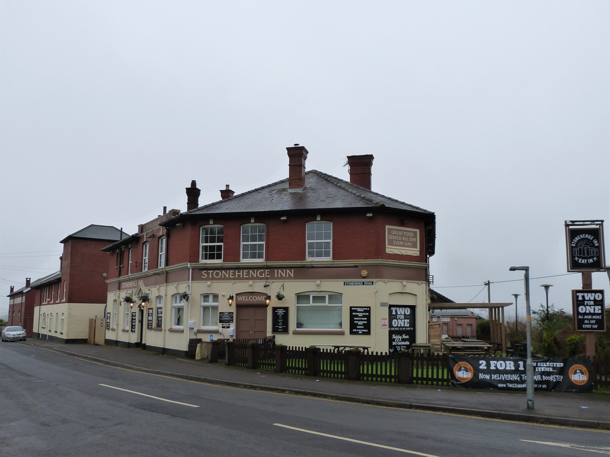
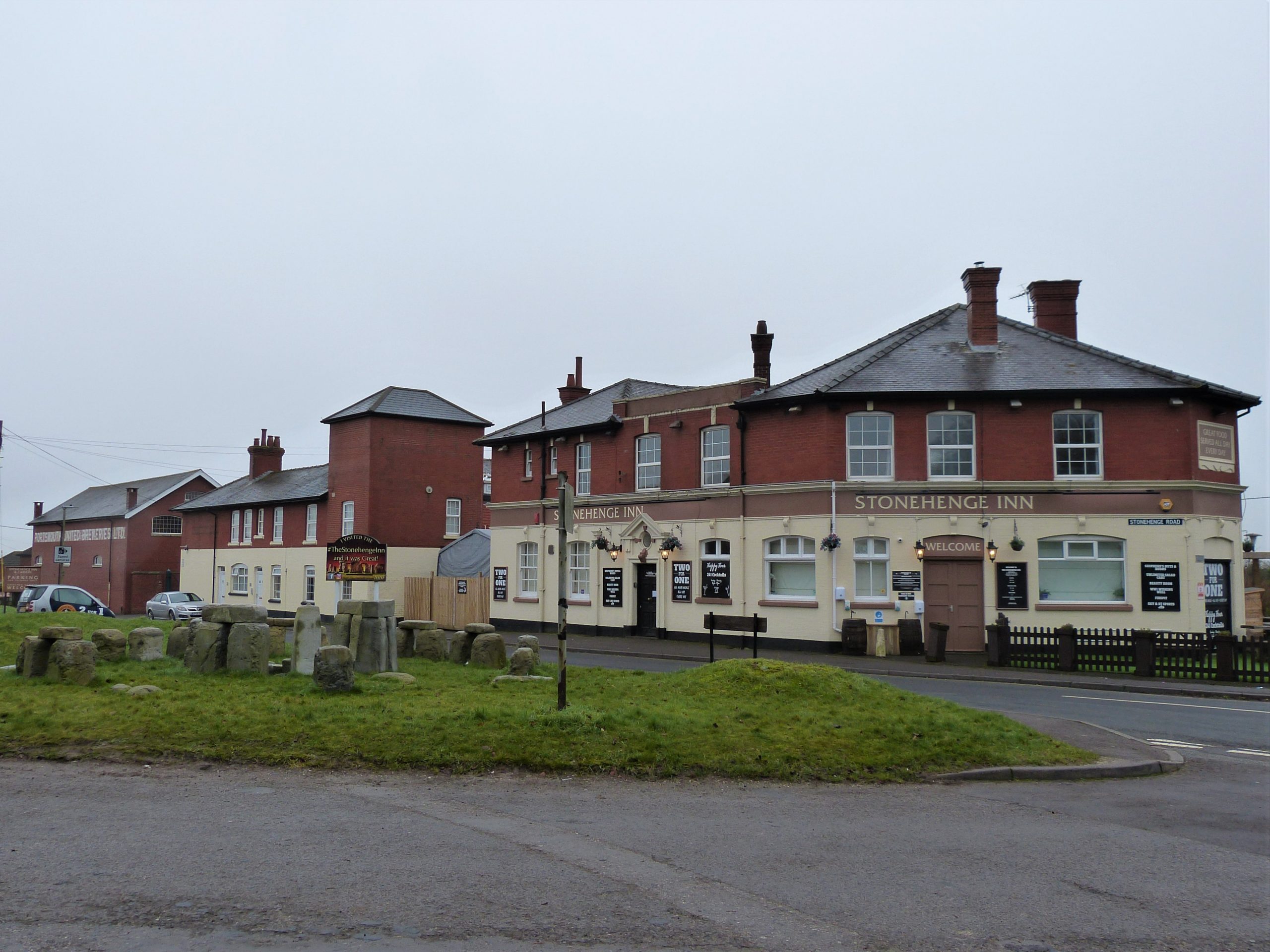
You are joining us now at about 8pm as we sit outside the Stonehenge Inn on the outskirts of the village of Durrington, just two and a half miles as the crow flies from the famous monument. We are going to spend the night here, camping in our cars outside the pub, but first we need to celebrate the day’s achievements. To encourage custom the pub is offering 2 for 1 meals and, because of Covid-19 rules, ordering food is mandatory at the moment when visiting a pub or restaurant; you can’t just order drinks. We both go for the fajitas, which turn out to be enormous plates full, and, to go with our meal, pints of English ale from the Stonehenge brewery I had recently walked past in Netheravon.
Again due to government rules our table for two is in a temporary marquee adjoining the pub – mixed households aren’t allowed to sit inside. The tall gas heater that looms over us helps us spend the December evening in comfort enjoying the entertainment provided by a pretty rowdy group of thirty-somethings. Being so close to Christmas this is of course the time for festive gatherings. We soon discover that our companions are all parents of children in a local football team and this is the occasion of their end of year party, a time to discuss (very loudly) the ups and downs of the season past. The pub takes last orders at 9:30 and everyone has to be out by 10pm, although I’m pretty sure our new friends would have, in normal times, continued into the small hours. Since we are to be sleeping just across the road the early closing is, for us at least, a good thing.

We had parked vehicles here yesterday and I had packed two self inflating Thermalite mattresses which I have owned for years. Clive now provides two army issue sleeping bags borrowed from his son-in-law-to-be. The seats in my seven person SEAT Alhambra fold down completely flat and with this combination I am hoping for a good night’s sleep.
Amazingly I sleep soundly until my phone alarm startles me awake at 06:00. The car’s windows are running with condensation and a map and book I had left beneath the windscreen are wet with it. I get up in eager anticipation of the morning ahead and put a kettle on the Camping Gaz. A check on Clive finds that all is well with him too. We had packed several breakfast items but in the end a cup of tea is all I need, food can wait after last night’s feast.
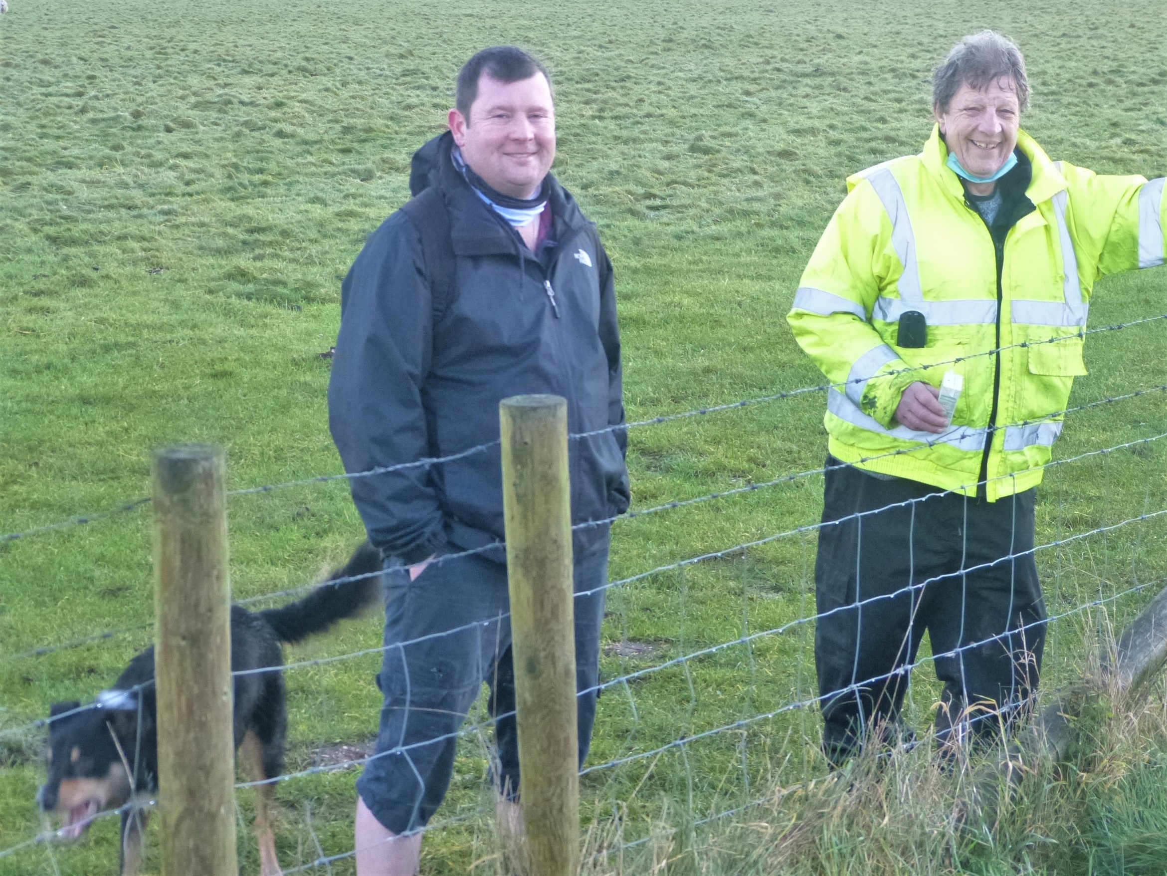
The biggest change this morning is that Clive and I are to be joined by Matt, another regular of the London Road Inn in Calne, who couldn’t join us walking yesterday because of work commitments. It isn’t long before he cruises up in his new car and we are all fastening on our walking boots. Matt has brought with him his Welsh Collie, Kez, and it is with a spring in our step, albeit a slightly stiff one for Clive and myself, that we set off. It’s 06.45, still an hour and twenty minutes before sunrise. The weather is pleasantly cold with hardly a breath of wind and above us the sky, crucially, is clear. Impressively, considering it is mid winter, Matt is wearing short trousers, cut just below the knee and a light coat, pockets filled with treats for Kez. Clive is still wearing his fluorescent jacket which reflects my torch beam as we walk away from our cars.
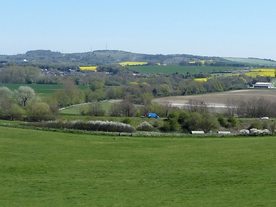
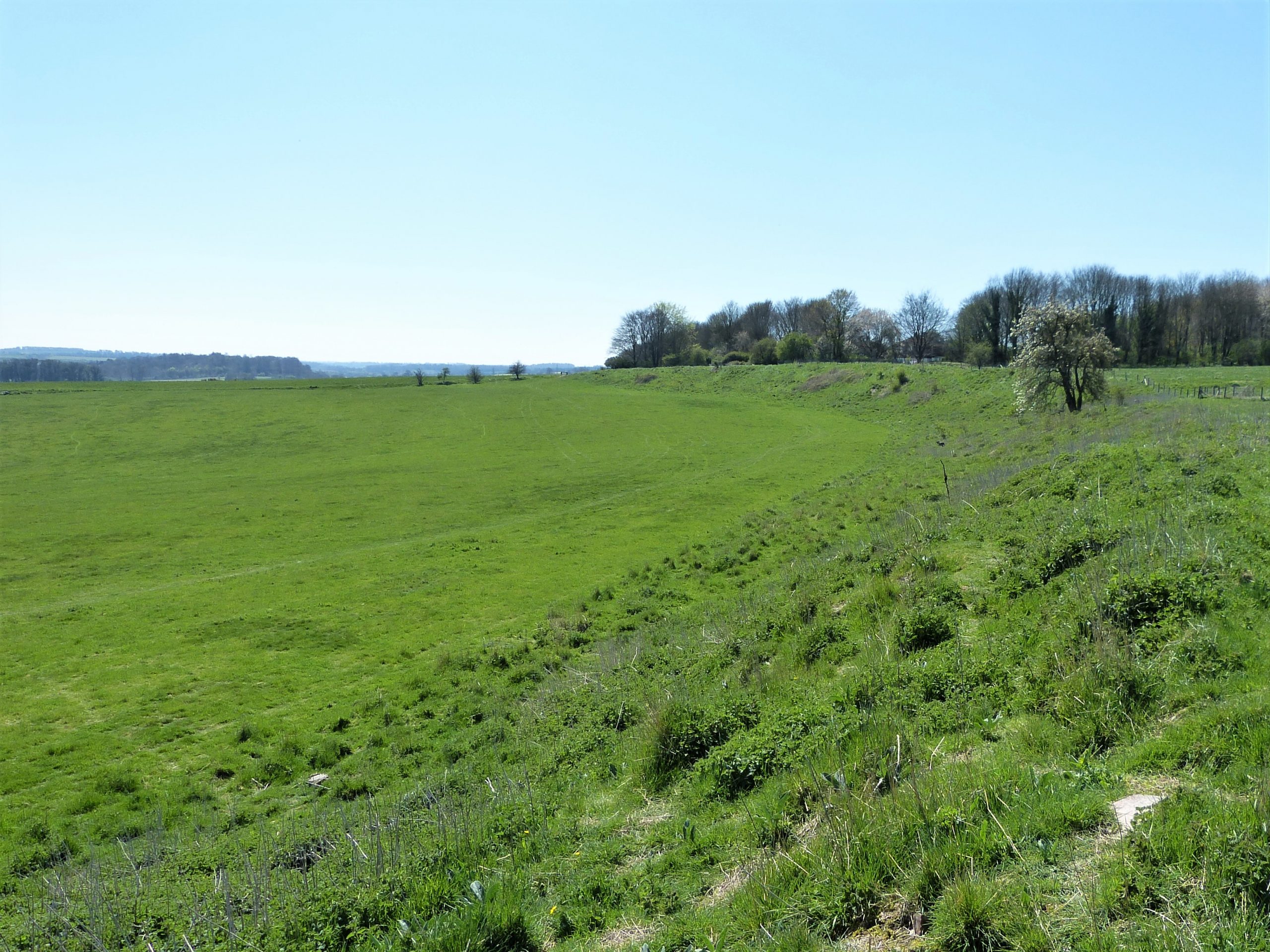
Having negotiated the Durrington roundabout we are soon walking gently down hill along the A345 which runs directly through the henge monument known as Durrington Walls. As explained in part II henges are circular banks and ditches unique to the UK that date from the late stone age, the Neolithic. Some, like this one, are massive and to our left now we can see the huge bank of the henge circle as it sweeps in a curve away from us down towards the Avon, the river whose valley we had been following yesterday. Durrington Walls was first recognised as a probable prehistoric site in the late eighteenth century but, apart from a drawing of the earthworks, no further investigation was made until relatively modern times, until in fact the A345 was straightened and widened in 1967.

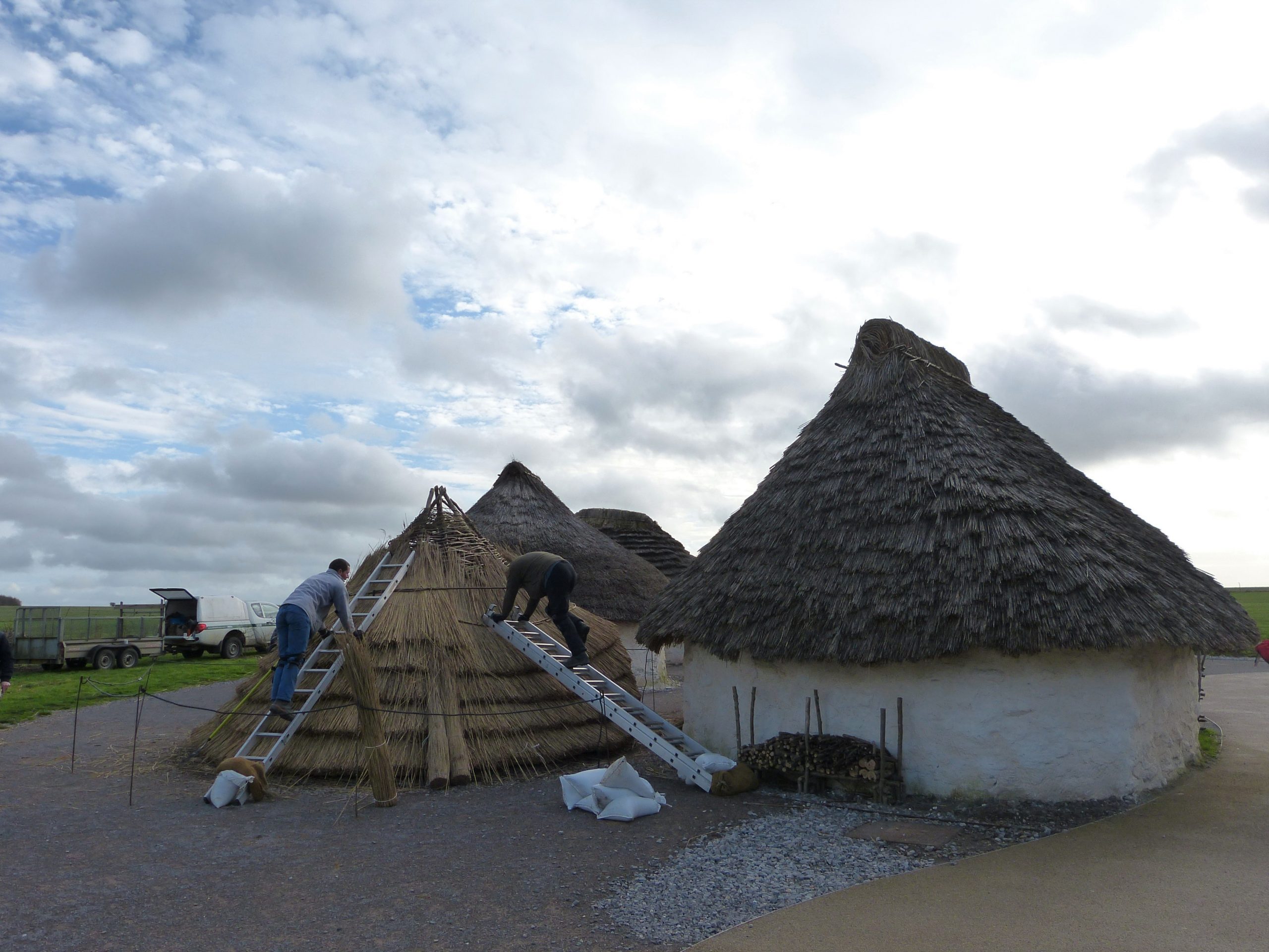
During planning for this new road it was agreed that a full archaeological excavation of the route should be conducted before the building work was begun, with a caveat that it should be done in a manner that didn’t unnecessarily delay the project. The archaeologist in charge was Geoffrey Wainwright and, because of the time restrictions, for the first time in UK archaeological history he used mechanical diggers to clear the first layers of top soil. It was a ground breaking excavation in more ways than one! The excavation project was the largest the UK had ever seen and it uncovered some crucial information: that the monument was contemporary with Stonehenge and that the enormous bank surrounded rings of huge timber posts set in concentric circles in a similar fashion to the stones of its famous neighbour. The main digging party, including Wainwright, ate, drank (copiously apparently) and slept in the Stonehenge Inn, which is one of the reasons I wanted to enjoy a meal and a beer there last night.
We cross the road and head up a footpath that follows the narrow course of the pre-1967 road deeper into the henge, eventually arriving at the excellent National Trust information boards. As a result of those first excavations the archaeological community became aware of the importance of Durrington Walls but it wasn’t till 2003 that an attempt was made to gain a more thorough understanding of the monument through some targeted research. The notice boards placed here contain information mainly gained from a series of excavations undertaken between 2003 and 2009 called the Stonehenge Riverside Project.
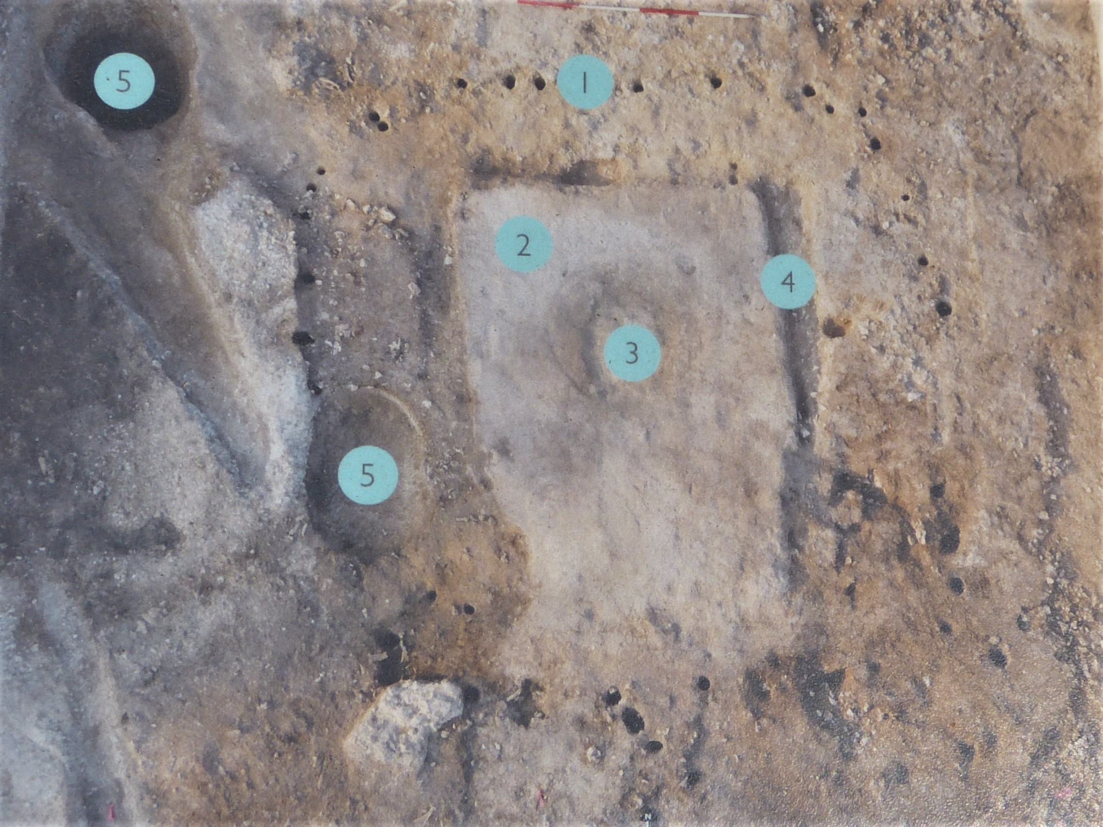
This millennial project lasted seven years and involved many of the leading archaeologists of the day. Between them they conducted forty five separate excavations across the Stonehenge landscape under the overall directorship of Mike Parker Pearson. The Stonehenge Riverside Project made some startling discoveries but the one that probably stands out from the rest was that Durrington Walls had been the site of previously unsuspected stone age houses. This is the first settlement of its type found in England and, containing probably hundreds of houses, it constitutes the largest village of its period discovered in north-west Europe.

In total seven houses were excavated but the total number can only be guessed at for now. To quote from Parker Pearson’s book Stonehenge. Exploring the greatest stone age mystery: ‘Durrington Walls had once been a huge settlement of 17 hectares (42 acres) filled with small, square houses whose surroundings were clogged with Neolithic trash from feasts that must have involved thousands of people.’ And since the sites are contemporary, we are pretty sure these were the people that built Stonehenge.

I mentioned in the last part of this journal that the remains of huge feasts had been unearthed at Durrington Walls and that many of the animal bones recovered were of nine month old pigs that had been born in the spring. This alone provides compelling evidence for an important winter event but it is just the starting point for a whole new interpretation of Stonehenge’s meaning. It is of course all theoretical but this new interpretation is I think, in the main, very convincing. I shall try to keep my explanation brief.
As a result of Stonehenge’s latitude the sun rises in mid summer and sets in mid winter on exactly opposite horizons, NE for summer’s dawn and SW for winter’s sunset. If you draw a line between these points where Stonehenge stands it forms the axis around which the monument was built. This has been understood for some time and for understandable reasons people have focused on the dawn alignment. The new theory, however, suggests that instead of watching the sun rise in June we should really be looking the other way in December, towards the setting sun of the winter solstice. And with all the new information this does make sense.

We don’t know any details of a contemporary religion or set of beliefs but the people that built Stonehenge were farmers and reliant on a knowledge of the seasons to gain the best results from their land. They were perhaps superstitious too. At any rate reaching the shortest day in mid winter for them was a major reason to celebrate: there were still cold days ahead but they knew that soon the days would lengthen and warm and mother earth would again become fertile. They might well have counted the days from this point so that crops were sown to their best advantage. And perhaps they also believed it was their priests and the rituals held at Stonehenge that ensured the days didn’t continue to shorten? I think it is important to inject ideas like this because it presents an image that we can easily appreciate but it is of course just my imagination taking over, so let’s look at some more of the science.
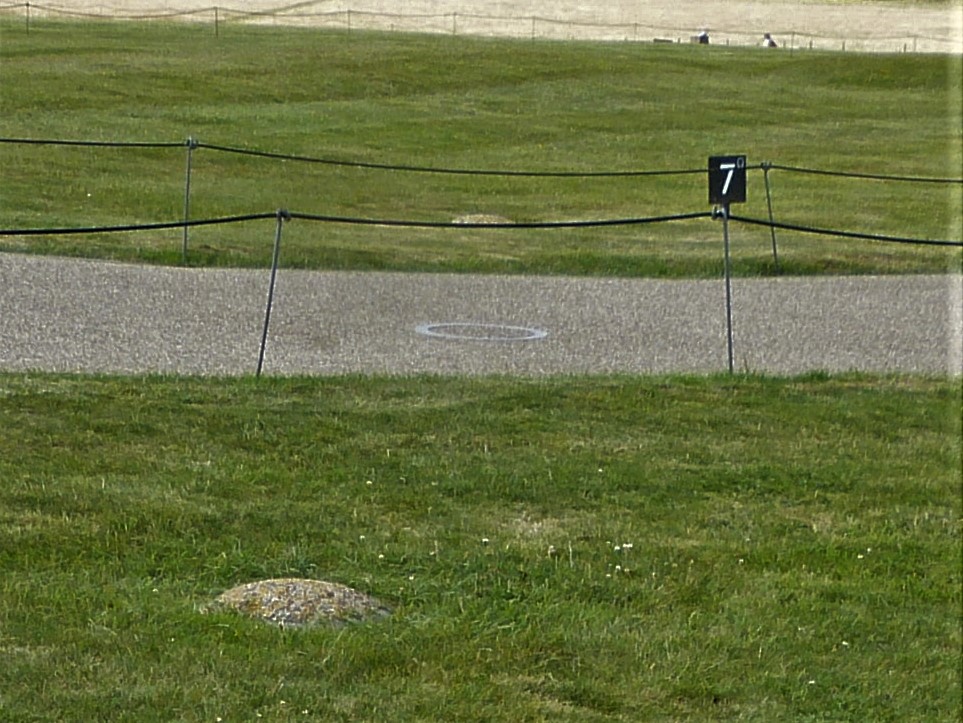
Since excavations in the 1920s we have known that there are a considerable number of burials at Stonehenge, probably well over a hundred, perhaps over two hundred. These were mainly cremation burials found in a circle of fifty two pits called the Aubrey holes that surround the stone monument in an evenly spaced ring about 100 metres in diameter. We also now know that these human remains date from about 3000BC, five hundred years before Stonehenge itself was built. There is no doubt in my mind that the people living at Durrington Walls, who we are sure erected the stone monument, knew of their presence, they were quite probably the graves of their ancestors. In that case they knowingly built Stonehenge in the realm of the dead.
It makes sense that the timber circles that Wainwright discovered in 1967, in among the newly discovered houses at Durrington Walls, were in some way for the villagers’ use. Perhaps the structures were used as temples and/or places of assembly for the elders. Parker Pearson believes that the stone version we know and love was similarly provided for the people buried in that ring of pits: a permanent temple/assembly hall for the ancestors made out of a material that will last forever.
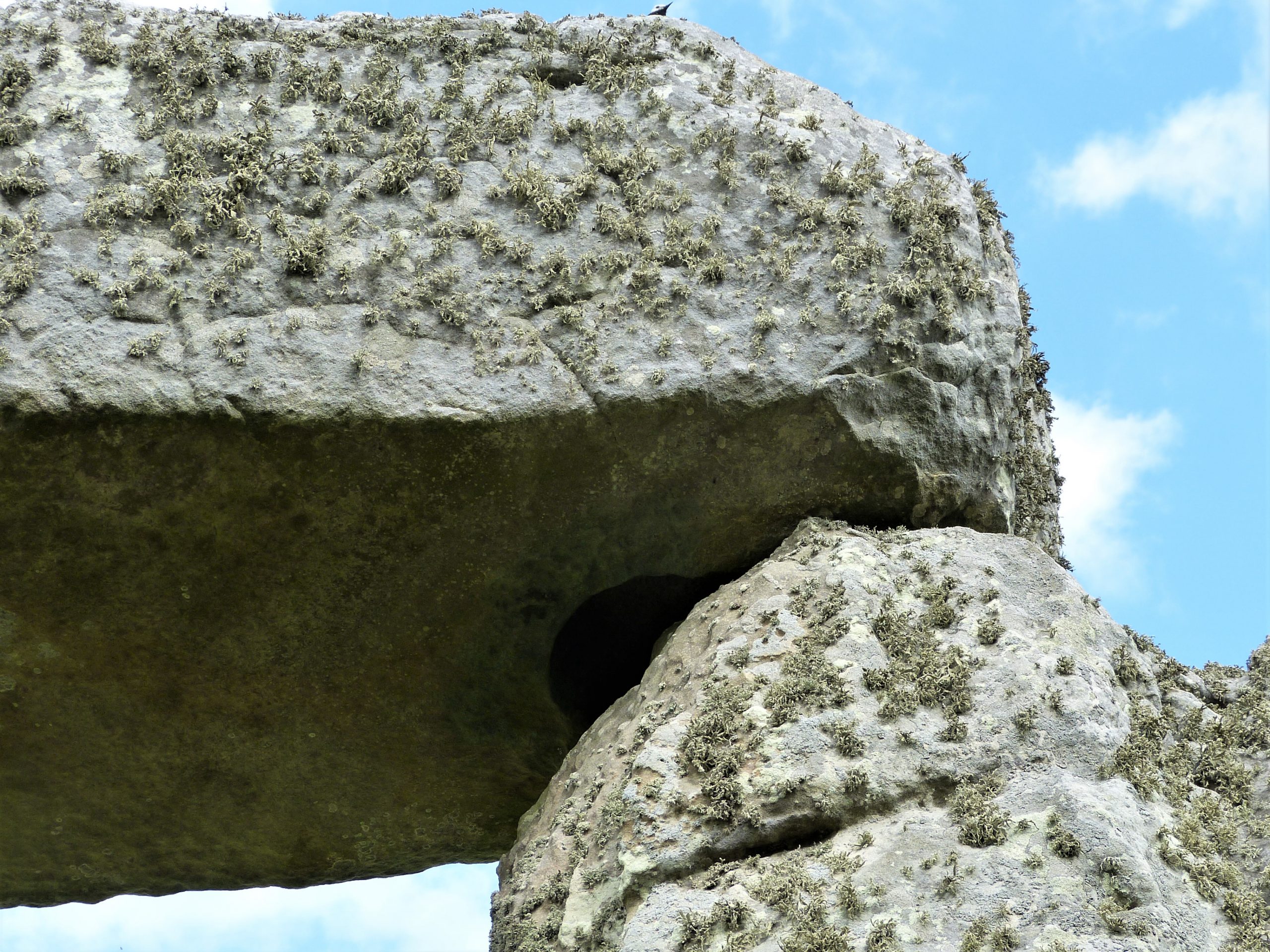
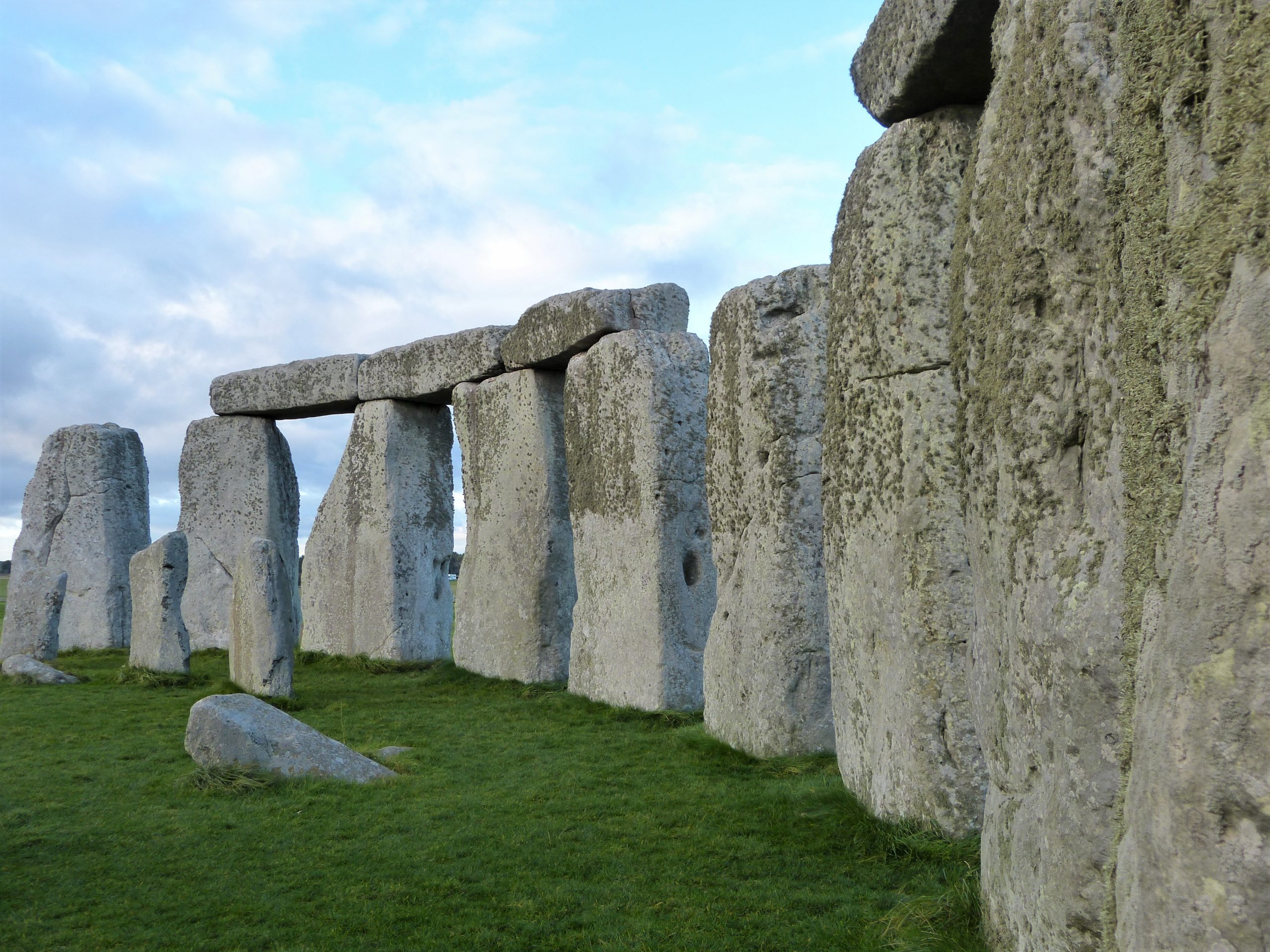
It has long been a mystery as to why the architects of Stonehenge used carpentry techniques when building the monument. It seems unnecessary but they carved mortice and tenon joints to secure the horizontal lintels unto the uprights and joined the lintels of the outer circle using the tongue-and-groove technique. They also first shaped the uprights into oblong pillars and the lintels to curve around the circle. When you take into account that the Sarsen stone they were carving is one of the hardest known, it all adds up to an extraordinary effort. But if you consider that they were copying the wooden temples of the land of the living and wanted to replicate them exactly, then it makes more sense.
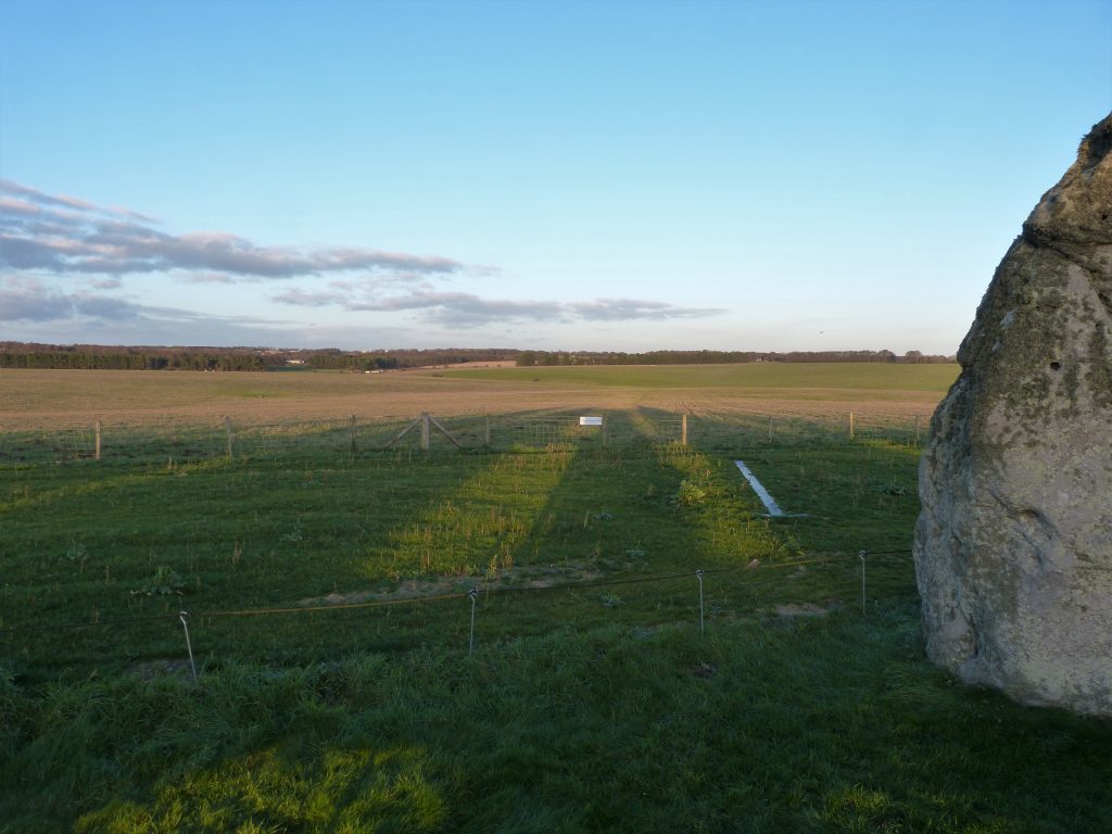
Midwinter marks the death of the old year but also the birth of the new. Therefore it would seem an appropriate time to celebrate the ancestors, and perhaps also the recently departed, especially if they believed in reincarnation. Analysis of animal bones tells us that the people who gathered at Durrington Walls didn’t all live there permanently but travelled from all across the UK to gather for special occasions, some covering hundreds of miles on their pilgrimage. Perhaps, and again this is my little theory, their midwinter festival included a mass funeral: families that had lost a relative during the previous year brought the cremated remains to Stonehenge as part of a collective ceremony that brought that year to a close. There is an avenue that leads from Stonehenge all the way, 1.8 miles, to the river Avon. Perhaps the celebrants followed this route to the river where the ashes were ceremonially deposited. The sun rises the next day giving birth to the new year and the cycle starts again….just an idea.
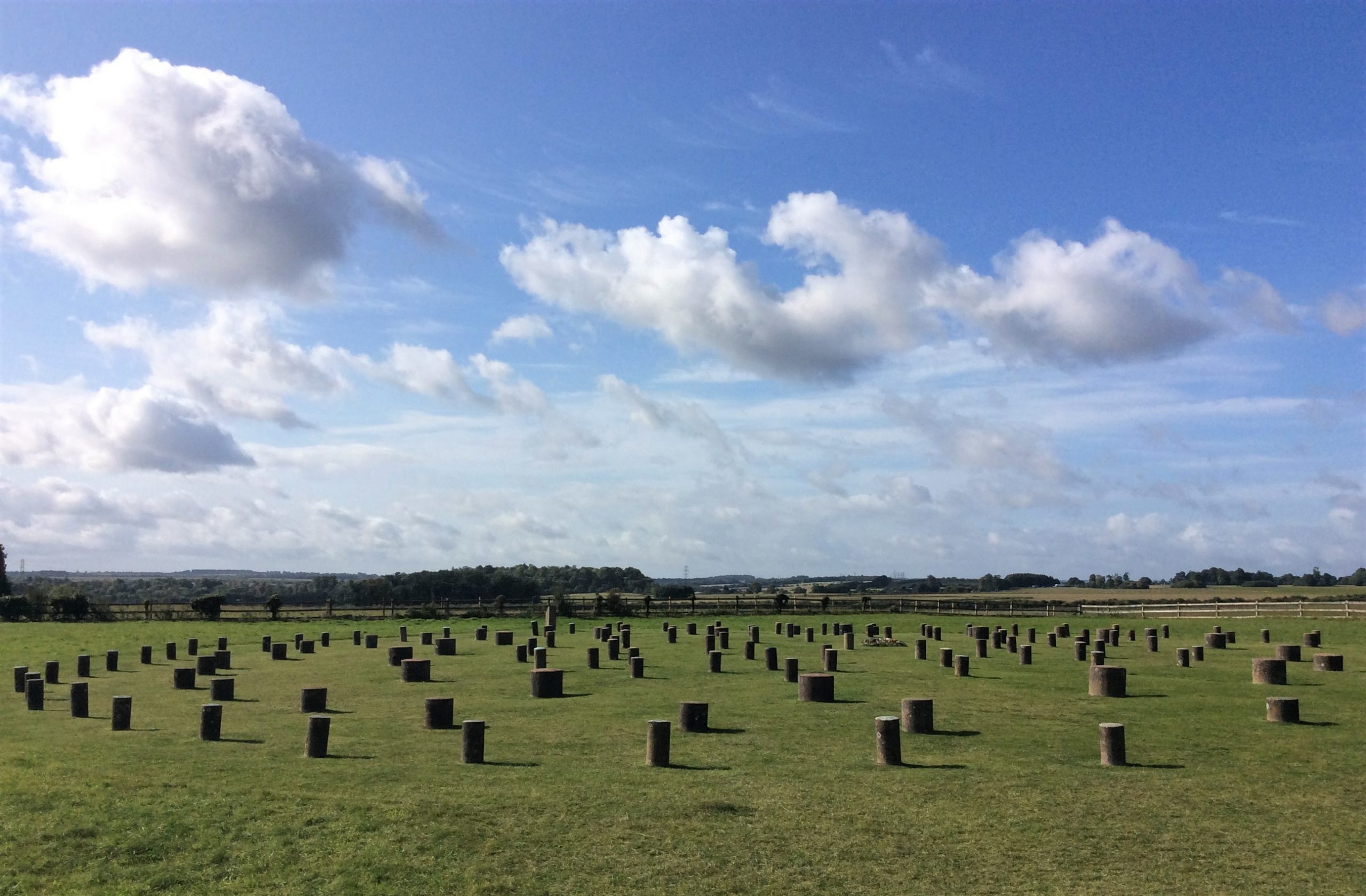
I have been a little nervous about how to break the news to Clive and Matt that we should probably be doing our walk this evening to see the sunset, so decide to leave the theorising till we get nearer the stones. We turn our backs for now on the banks of Durrington Walls and head across the road and into a field of tussocky grass. To our left is Woodhenge, another contemporary timber version of Stonehenge, which was discovered in 1925 long before Durrington Walls across the road shared its secrets. The original excavators led by Maud Cunnington erected knee high circular concrete pillars to indicate where massive timbers had once stood. As is the norm with these timber structures there were six concentric circles always with an even number of uprights. Free to visit it is a great place to get an impression of the scale of these timber temples/monuments. You can park your car here and walk like we are today to Stonehenge in the footsteps of our ancestors.
We only have time for a quick look at Woodhenge in the lifting darkness before we press on south west across the field. Kez, Matt’s Welsh Collie, runs off leading the way, his head hanging low in a lupine fashion, his back legs seemingly trying to out run his front so that he trots along at an angle of twenty five to one on the clock face. They have walked here before and Matt reckons his dog has either remembered the way or is just following the scent left by other people on the path. Kez is very well trained and knows to wait for a treat from his master where a gate or stile ends a field. I am nevertheless concerned that he should be on a lead, there are often sheep in this field and I am sure we will meet cattle and sheep in the landscape around Stonehenge; but Matt assures me all will be fine.
We follow Kez to the far corner and turn right onto the route of an abandoned railway, the lines of track long since removed. Known as the apple track the wide route is lined by hedgerows of native plants regularly interspersed with apple trees grown from the pips of cores possibly thrown from trains. During the first world war this military light railway brought troops and supplies from Amesbury to the camp at Larkhill. The track was torn up in 1935 but the trees give a gentle reminder of the men who were trained here before embarking for the trenches of France.
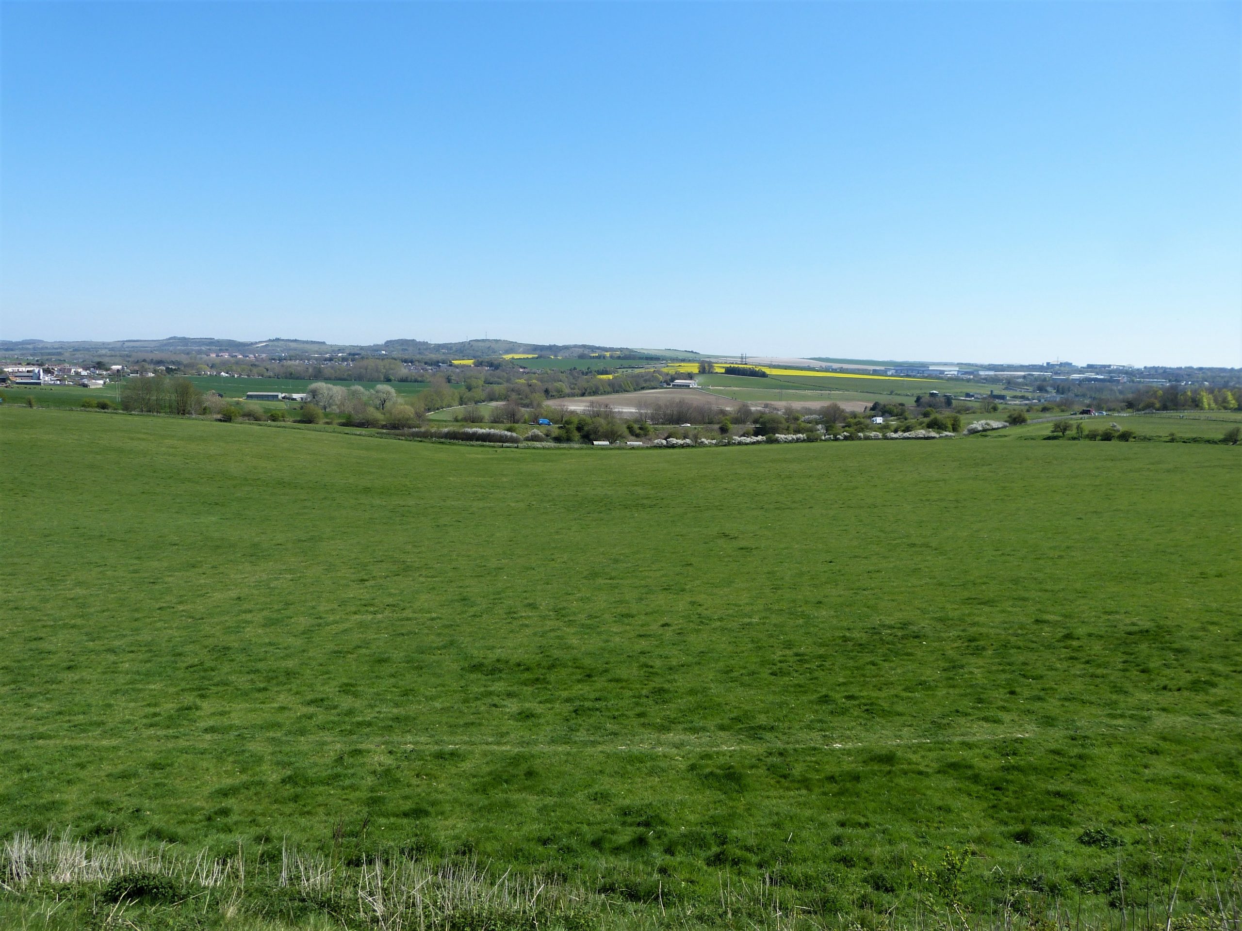
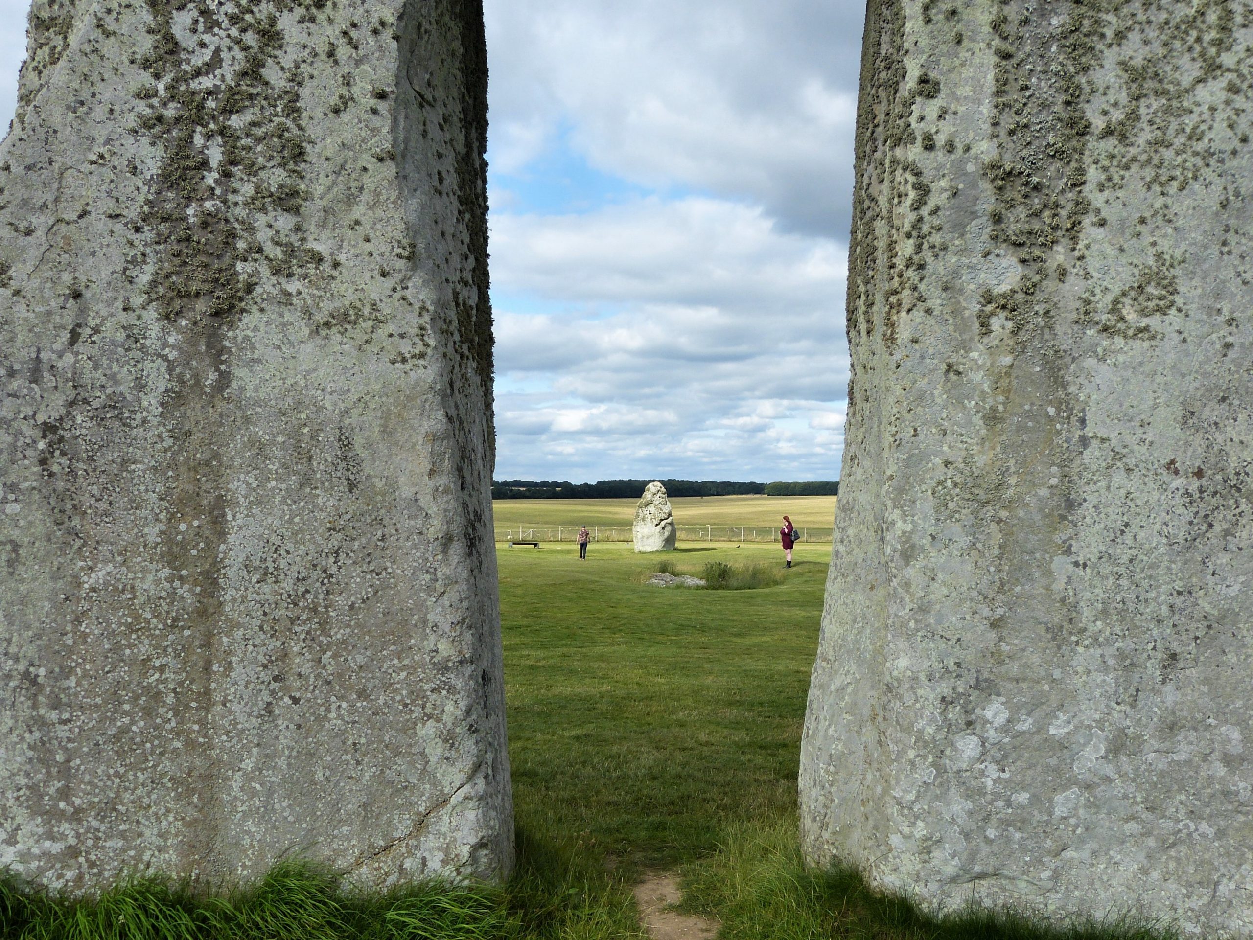
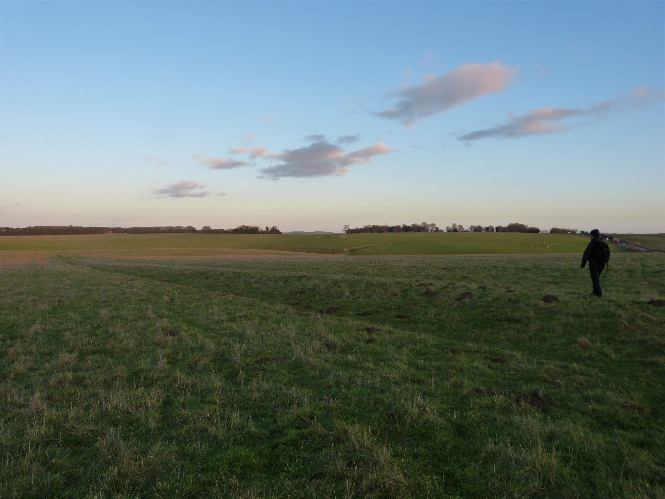
I am on very familiar ground here as I often include this walk on one of my tours so it is nice not to have to think about the route. The track narrows now as we progress uphill, fields and long views to our left and, soon, the gardens of officers’ houses on our right. Larkhill is still a garrison town and is home to the Royal School of Artillery, whose guns and gunners can often be heard practising on the plain to the north of us. Passing a paddock with two feeding horses we reach King Barrow ridge. Running away from us to the front is an early Neolithic monument known as the Stonehenge Cursus, just one of many ancient monuments that share the landscape with Stonehenge. This huge earthwork dates from a thousand years before the stone monument but is otherwise an enigma. It was never more than a pair of parallel banks and ditches set about 100m apart that run straight across the landscape for about 1.7 miles from where we are standing to the ridge in the distance. One suggestion is that it creates a boundary between the land of the dead and the land of the living but nobody actually knows for sure what its significance was.
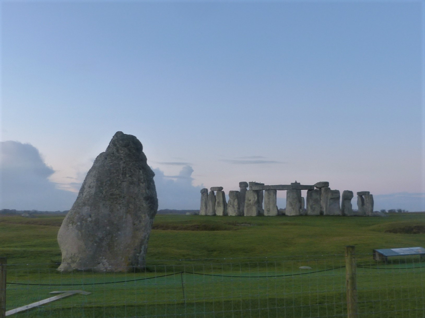
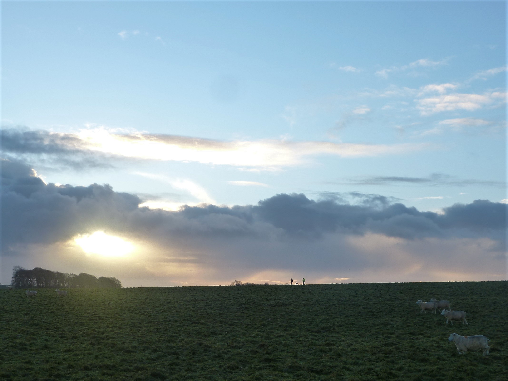
Most importantly, however, from here we get our first distant sight of Stonehenge, showing very dimly in the blue quarter light; our destination is within reach. We turn left to walk along the ridge which is dominated by large bronze age burial mounds, the ‘old’ and ‘new’ king barrows, most of which support mature beech trees or stand, grass covered, half hidden in brambly woods. Kez gets excited here and picks up a stick, barking and growling with us to play with him. We are advised that the only thing to do is ignore him and he will eventually give up, which, eventually, he does.
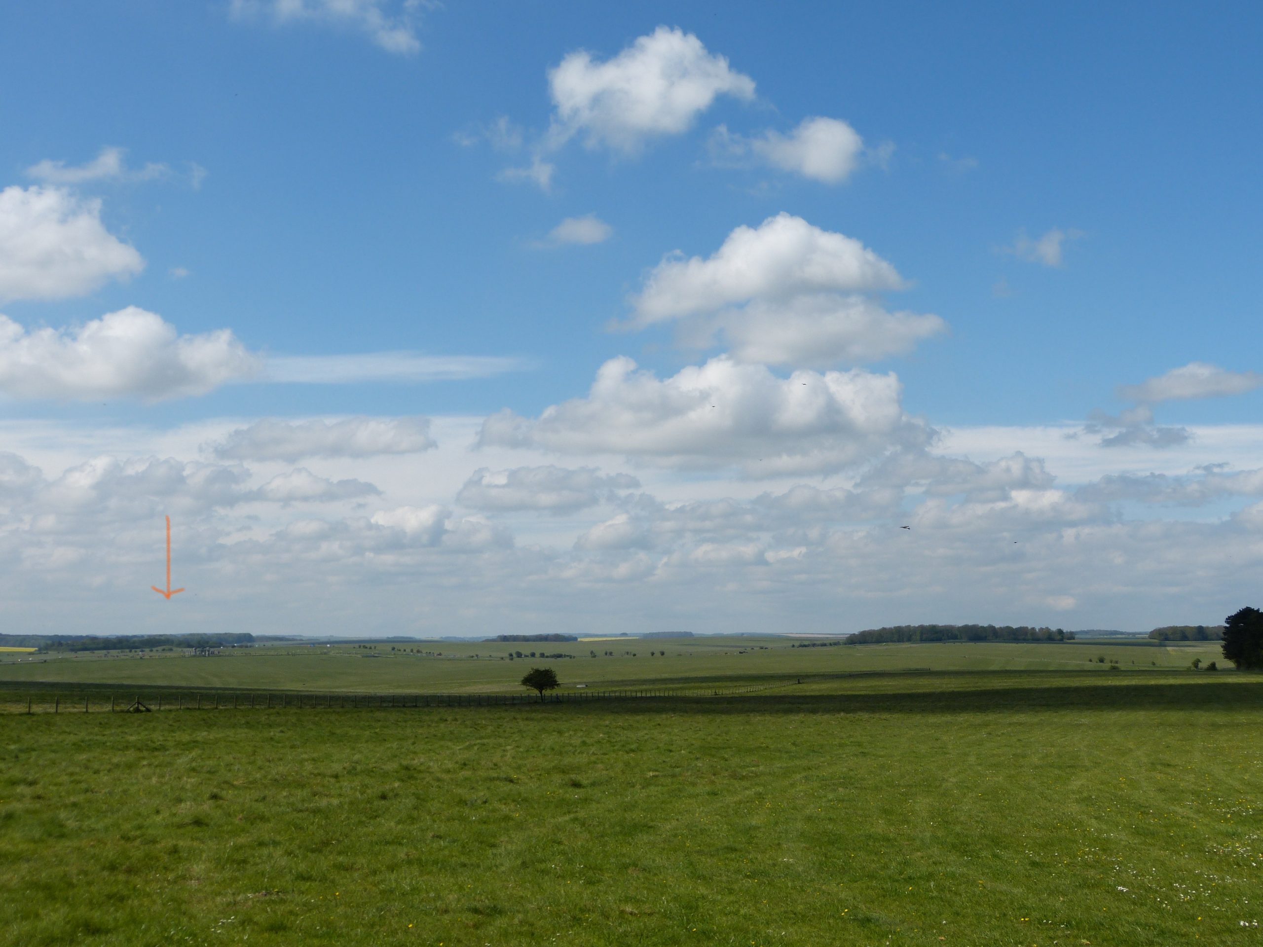
It is easy walking here and we chat happily and enjoy the views. It is brightening fast however and I start to worry that we might not be at the stones in time. It isn’t long though before we arrive at the previously mentioned avenue which leads from Stonehenge to the river. Mike Parker Pearson, I should say however, reckons it leads the other way, from the river to the stones. If you remember his project was called the Stonehenge Riverside Project and its main original objective was to see what role the river Avon played in this landscape of monuments. Knowing that Stonehenge had its own avenue to the river he hoped to find a similar connection between the river and Durrington Walls. In year one he managed just that, finding a wide roadway of packed flint leading from the southern of the henge’s timber circles to the water: the Durrington avenue. Noticing that the southern circle at Durrington and its avenue are aligned on midwinter sunrise he developed a theory and this is the picture it paints:
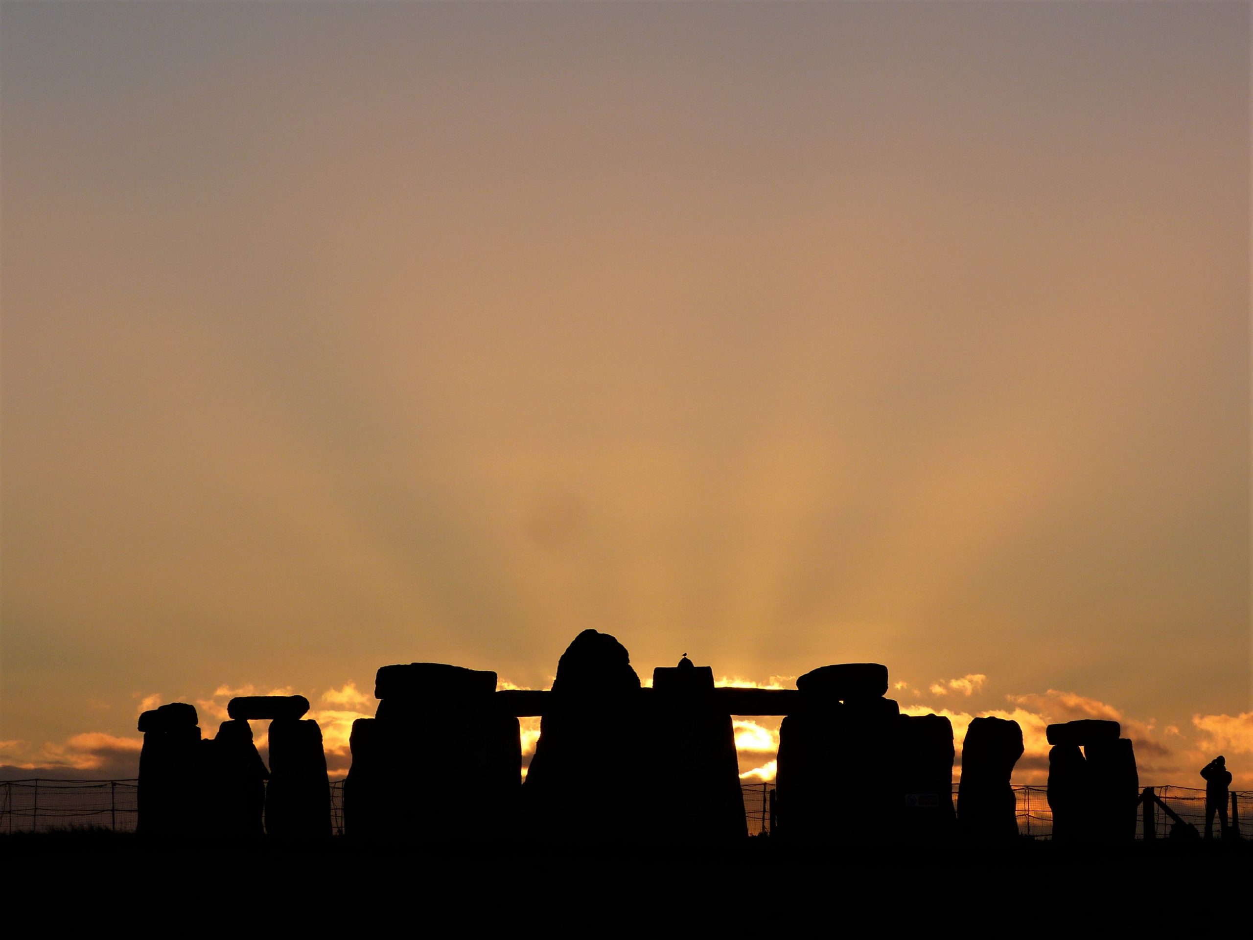
At dawn in midwinter celebrants watch from the southern circle at Durrington as the sun rises in its predicted place. With full ceremony they process towards it and the river Avon along the wide Durrington avenue. Here they embark on rafts or boats to follow the river as it meanders downstream until, arriving at the end of the Stonehenge avenue, they disembark. Appropriately during the Stonehenge Riverside Project they discovered the site of a stone circle at this point, where the celebrants might now partake in a ceremony of sorts. From here they process up the Stonehenge avenue which runs first to the north-west before turning west to cross the ridge where we are standing and down into the valley in front of us. At the valley bottom the stones are briefly hidden from view behind the rising ground to the left and it is here that the avenue turns sharply to run its last section south-west. The celebrants have perhaps taken all day to get to this point. As they ascend the slope towards the monument it rises out of the ground in front of them, slowly revealing itself. They then have the spectacle of the sun setting directly behind the monument as they make their final approach.
It’s a pretty neat story but I still think it is the other way that is important and it is the revered sun that makes me think so. You see, as the midwinter sun sets behind Stonehenge, standing as it does high up on its dome of land the shadows it casts lengthen and lengthen and lengthen again straight down the demarcated avenue. They become impossibly long reaching all the way down the slope, over 400 metres, to the point where the avenue turns to head towards the river. Surely this was an important and planned piece of theatre, it is just too good not to be.
We follow the avenue down off the ridge, Kez again leading us on. Beyond the gate at the bottom is a large dispersed grazing flock of sheep and it is here that I discover why Matt was not worried about Kez’s behaviour. Despite being a Welsh Collie, Kez is scared of sheep! He will do his best to avoid them, usually by taking the long route around the whole flock. With us as back up today however he braves up and walks with us, the sheep calmly separating in front of us.
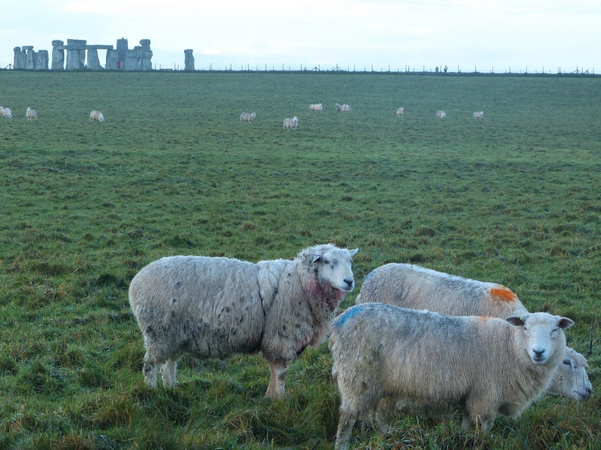
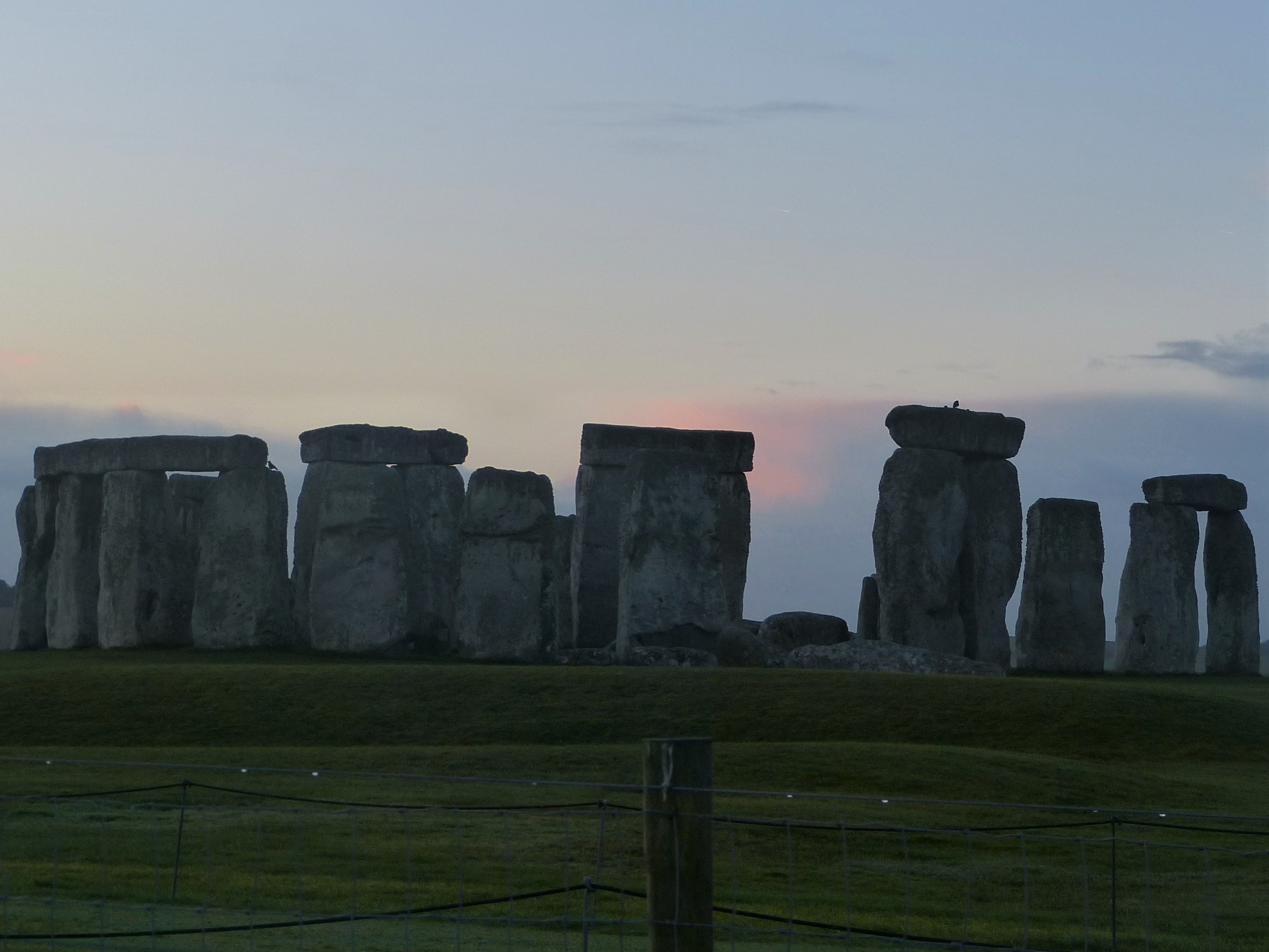
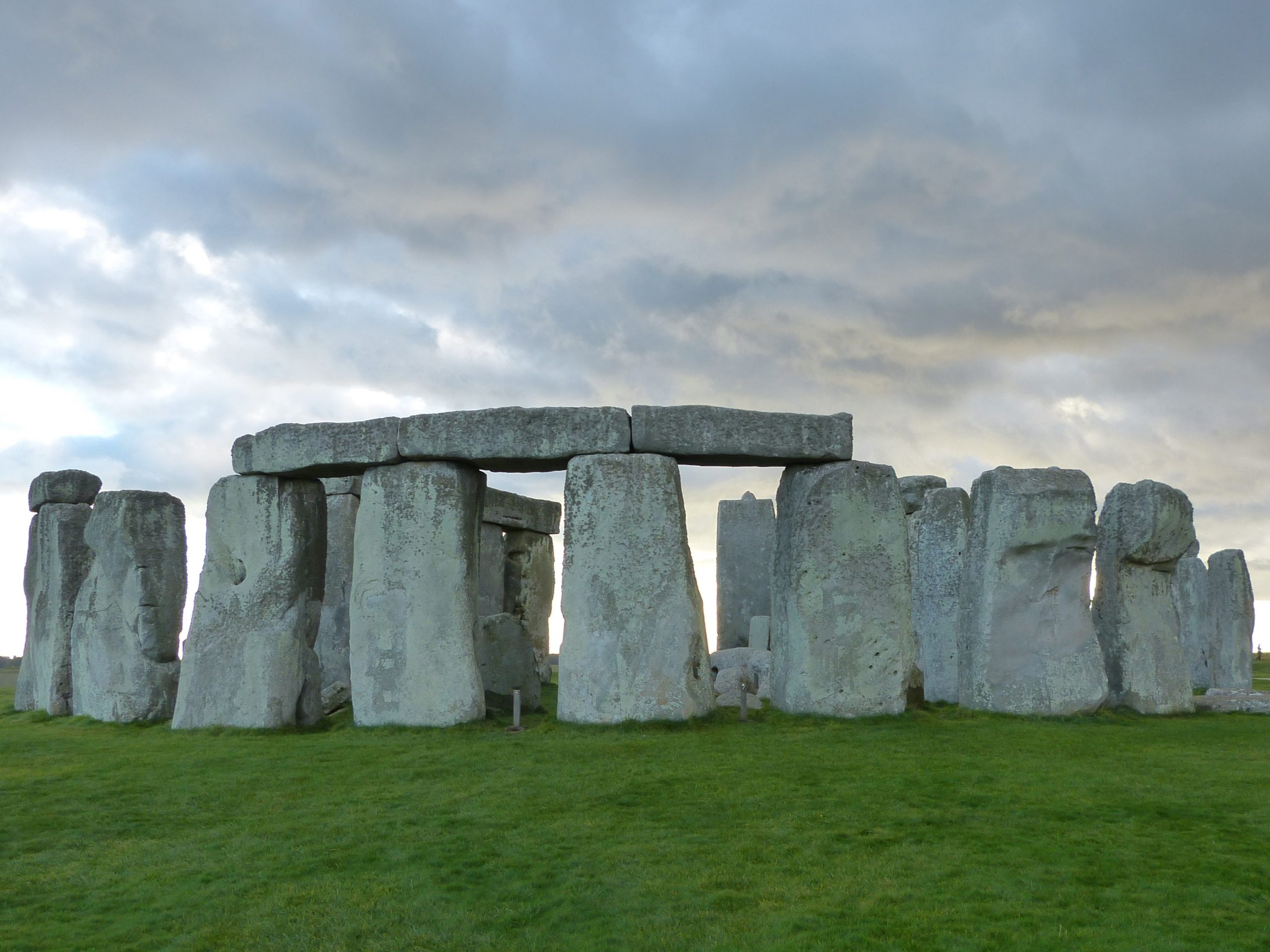
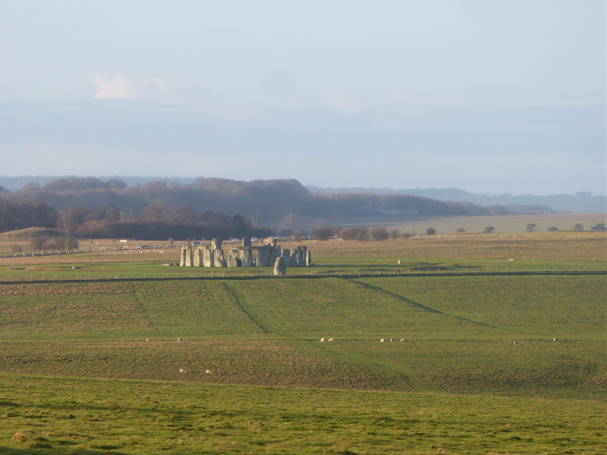
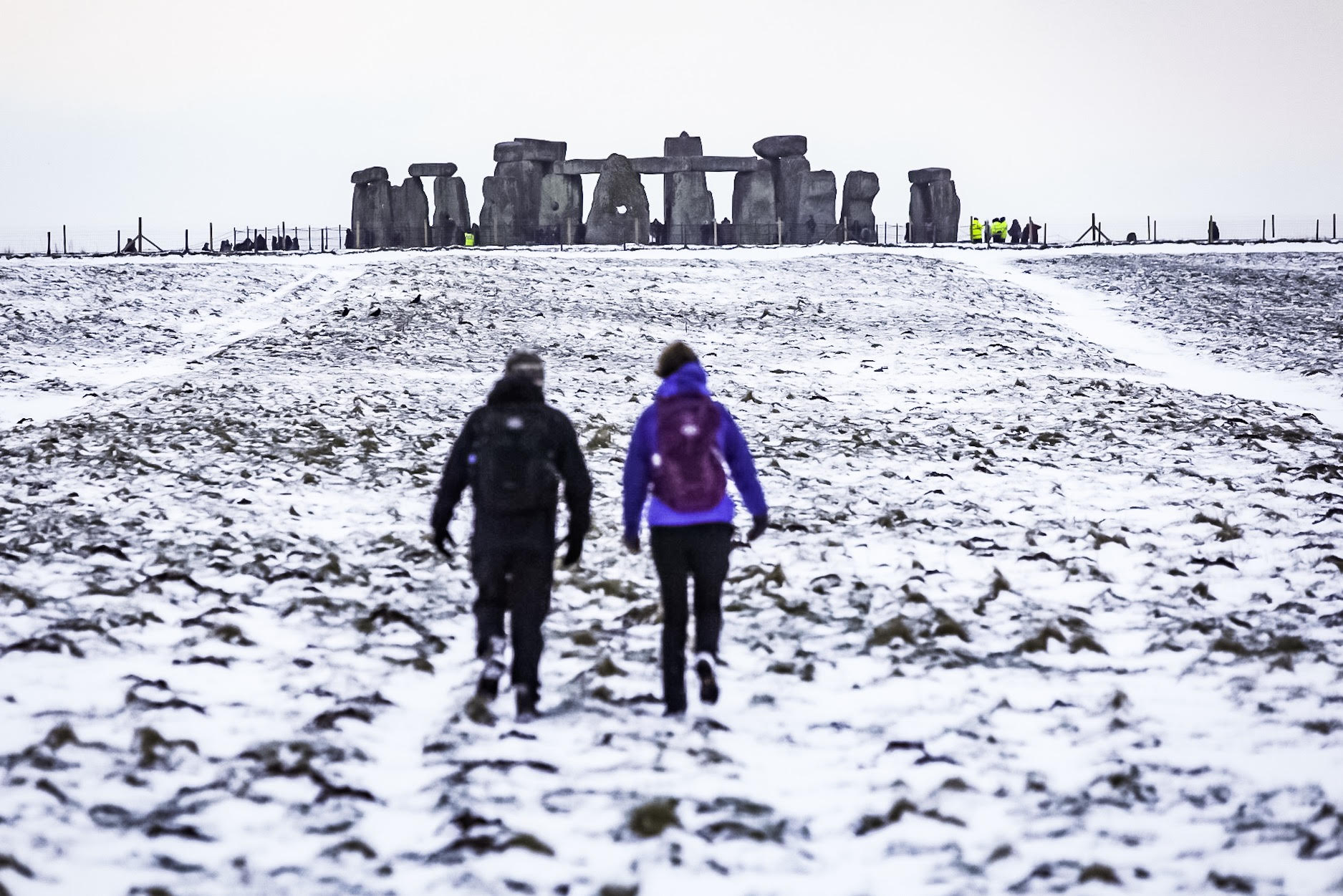
As Stonehenge looms large we can see that there are very few people here. A group of about twelve, who seem to be part of a guided tour, are standing off to our right and a family is approaching from the direction of Amesbury. During normal years there are four occasions when the general public can walk up to Stonehenge at dawn without a ticket and wander in among the stones. The winter solstice is one of them (the others being the summer solstice and the two equinox mornings) but Covid rules mean that today we all have to stand behind the fence. At the moment the only people within the boundary rope are security guards and English Heritage staff.
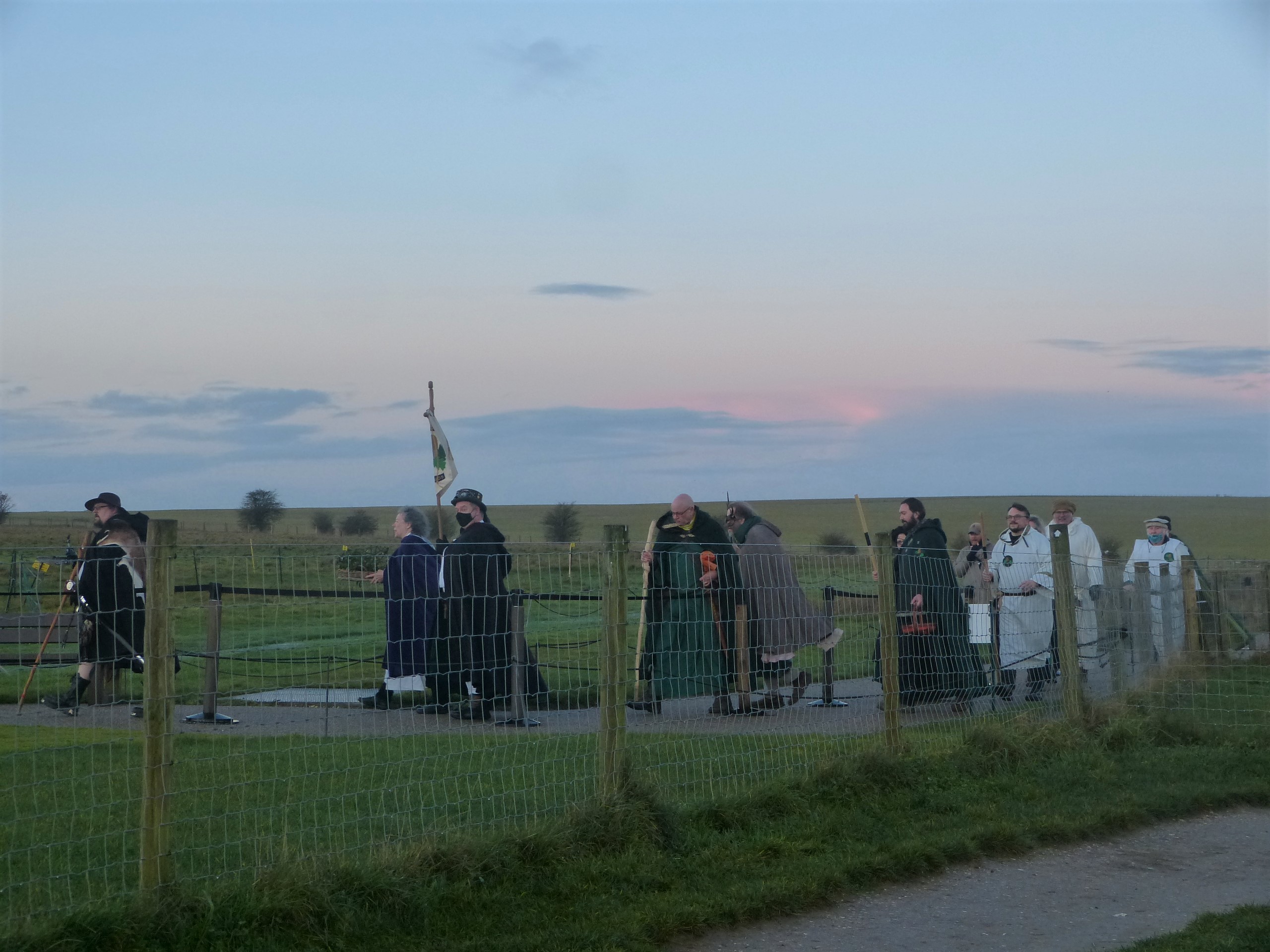
The sky above us is still clear but as daylight creeps in we can see a low bank of cloud sitting on the eastern horizon. It is ten minutes to eight, with the sun due to rise at eight minutes past and the pastel blue sky above the grey clouds is taking on a salmon pink hue. All is calm and everyone looks on expectantly. Just before eight a minibus comes down the lane from the visitor centre and a group of twelve men and women climb down. They walk in a long line chatting and smiling towards the stones. Most are dressed in long robes or gowns with heavy cloaks thrown over their shoulders and clasped at the throat; some are more simply attired in plain white robes belted around the waist. A few have hats but all are carrying something, a tall staff or a basket of offerings. The man out in front has an impressive silver-hilted sword sheathed in a black scabbard on his left hip, a deer skin on his back. A black-caped man behind him carries a tall standard with, among other things, oak leaves emblazoned on it. These then are modern day druids who have been given special permission to celebrate dawn today within the stones because of their religion.
Modern druid beliefs include a form of animism, where everything around them is filled with a flowing spirit, their ‘god’ is the natural world, Nature in all its guises. The all-pervading life force is known to them as Awen which can, if desired, be equated with the god of an established religion such as Christianity – not all druids are pagans. Often ridiculed as tree-huggers, etc., they believe in peace and being at one with the world they share with Nature; modern druids believe in safeguarding the planet and I can’t see anything wrong with that. It is a very simple and fluid set of beliefs, with a broad scope and few rules, and much less dogma than the various structured, established religions. Each follower has the freedom to find their own path; ‘so may it be’ rolls readily off their tongues, ‘blessed be’ is their ‘amen’.

Modern druidry aside, one thing I should add is that, contrary to an often held opinion, the building of Stonehenge had nothing to do with the ancient druids. They were a caste of Iron Age priests operating in what are known as the Celtic lands of Gaul and Britain. The only references we have for them are in the writings of classical authors such as Tacitus and Julius Caesar and it is unlikely they existed before 600BC. Stonehenge was built, rebuilt and added to on several occasions between 3000BC and 1600BC, it is a Neolithic and Bronze Age monument.
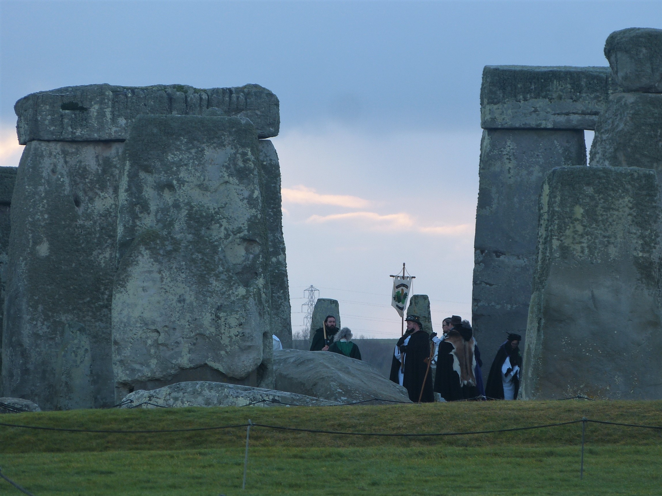
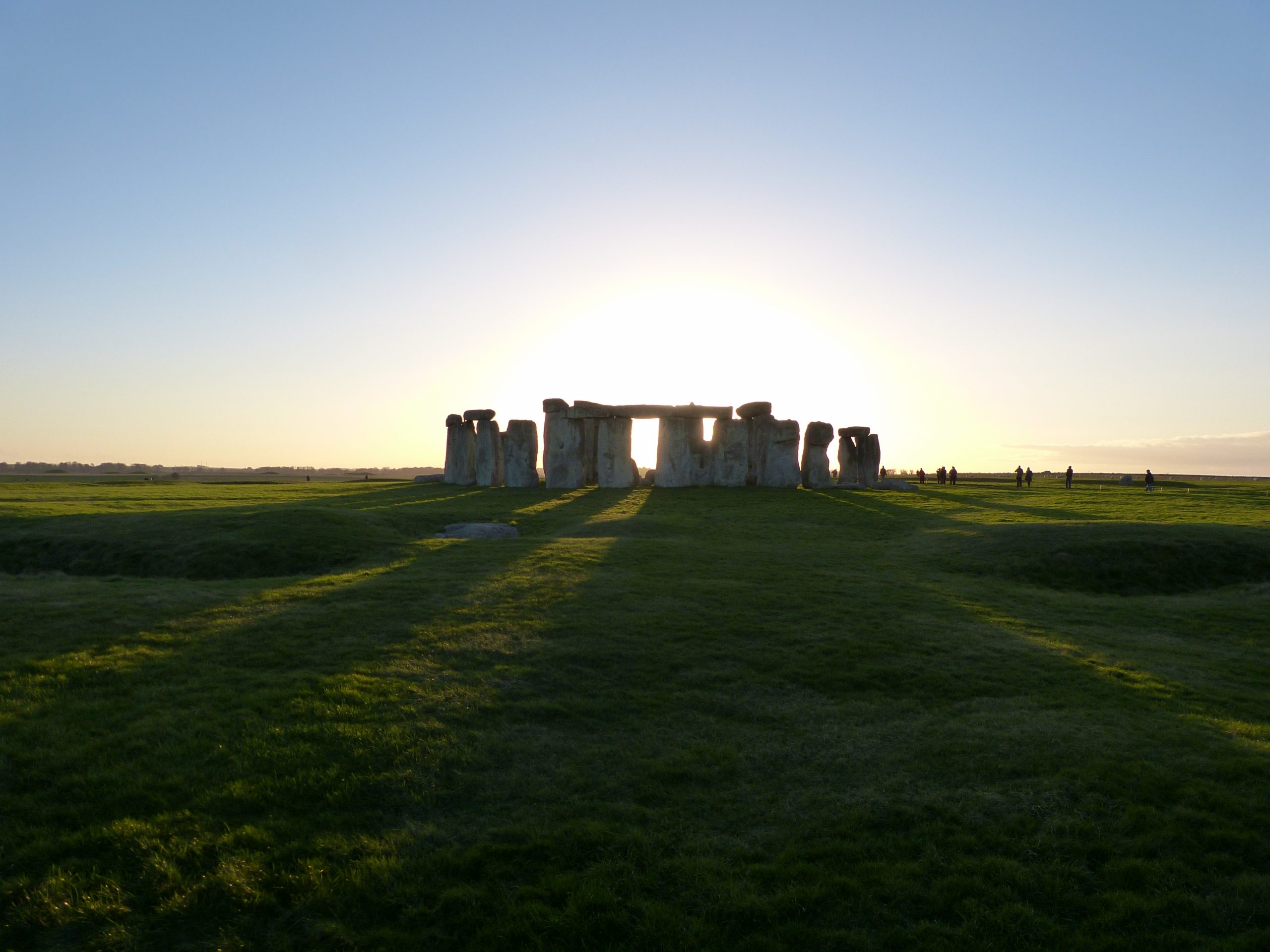
We watch the group process into the centre of Stonehenge and begin their rituals, forming their own circle within the rings of stone. The sunrise moment comes and goes with the sky becoming a little rosier and brighter, the grey clouds tinged with colour. After an half hour or so taking pictures and chatting with others who have turned up for the event we decide it is time to head back to the cars, our pilgrimage complete.
We head diagonally back across the fields continuing along the initial north east line of the avenue, down into the valley known as Stonehenge bottom and back up the other side, walking towards that point on the horizon that holds the attention of thousands of faces at midsummer dawn. It isn’t until we are half way up the slope on our short cut back that the sun fully appears from behind its clouds. Turning around it shines brightly down for us on to the extraordinary stone monument we have recently left, set as still as a gemstone in its green fields of sheep; it’s going to be a beautiful day and we all hope that augurs well for the year ahead.
I am certain that when life returns to normal, Stonehenge will continue to be a focus for celebrations particularly at mid summer. And that I believe is correct, because that is the time when the monument holds the most significance for those that have re-purposed it in the modern age. However, I am glad that I have completed my winter pilgrimage out of respect for the wisdom of those who built it, and I’m also sure that it won’t be for the last time.
For those interested in reading more about the Stonehenge Riverside Project, Mike Parker Pearson’s book Stonehenge the Greatest stone age mystery makes very enjoyable reading. I have put a link to it here.
The full project publications can be found here.